Previous Page
Landfall Homepage
Many of the descriptions of San Salvador in the Diario are too vague to be of much use in comparing the various theories against each other. For example, Columbus describes San Salvador as "green" and "flat", but compared to his previous landfall in the Canaries, any island in the Bahamas could be considered green and flat.
Question: can the strengths and weaknesses of the many landfall theories be objectively evaluated? The prospects for such a delicate enterprise will be enhanced if we write down each important description in the Diario and then compare the several competing theories with each description, assigning a score or ranking to each. I have done this in Table 1, printed at the start of this article: the Columbus Landfall Theory Scorecard. In 1986, Arne Molander[21] performed a similar numerical evaluation, when comparing the Watlings and Egg Island theories. The current evaluation is different in that: [a] it includes seven theories, and [b] the clues are not ranked as to weight. Also, there are quite a number of differences in which clues are included and which are excluded. I have concentrated on quantitative descriptions in the Diario: distances, directions, and existence of fixed features; and generally excluded those clues for which only circumstantial evidence is available for evaluation. For example, Molander gives Watlings the edge on cultivation of cotton; I have excluded this clue, on the grounds that the best current evidence is very spotty, regarding the distribution of native cotton in the pre-Columbian era.[22] Also, I have assigned a score to each clue for each theory, not just to that theory which is superior. These scores are necessarily subjective, and therefore open to debate. I can only state that I have made every effort to be as objective and fair as possible, and have tended to give theories the benefit of the doubt whenever possible.
To win the debate, a theory must show its clear superiority over every other competing theory, and through the entire track from San Salvador to the commonly accepted later Ragged Islands landfall. As the Scorecard shows, the only theory that can do this is Plana. In order to find out why, let us again trace Columbus's track, this time going forward from San Salvador, evaluating the various theories with respect to the Diario.
One of the most famous parts of Columbus's account is his sighting of land on the night of October 11 in the form of a dim light in the west. This sighting has generated controversy among Columbus scholars, primarily because the sighting took place at 10 p.m., four hours before land was actually sighted --- at 2 a.m. on the 12th (by Rodrigo de Triana of the Pinta, which announced the historic moment via pre-arranged signal). At the speed the fleet was travelling that night, Columbus must have been about 35 or 40 nautical miles from San Salvador: an impossible distance to see such a light, in spite of attempts to prove otherwise. Some islands have an advantage in this regard, however, since it is possible that the fleet passed close by another island earlier in the night, from which the light was seen. Proposed landfalls which have such an island to the east rate a 3 on the Scorecard; those which do not are forced to rely on Morison's explanation that Columbus's eyes were playing tricks on him. Morison's explanation seems unlikely, however, since at least two other persons saw the light at the same time; but in the interests of mercy, we will evaluate these landfall-theories with a 1, instead of a 0. [After spotting land at 2 AM of Oct.12, Columbus held position, a few miles to the east of San Salvador, until dawn. It is a historian's privilege to empathize with the discoverer's ecstatic frame of mind in these first post-uncertainty hours, during which he could at last savor the realization that the visionary success he so deserved had actually come true. One doubts he spent any of these hours in sleep: indeed, his diary entries for Oct. 11 & 12 run together. Finally, as the grand morn of Oct.12 broke, his party --- spying a flock of curious natives on the beach --- went ashore.]
The important question of San Salvador's size poses a knotty problem, since the Diario does not give the size as a quantified measurement; and because two other sources (Las Casas's Historia de las Indias and Ferdinand Columbus's biography of his father) each describe the size of the island as 15 leagues. Morison has speculated that the 15 leagues actually refers to the size of Island II, and somehow was attached to San Salvador by mistake. [A mistake which might be related to Columbus's or a follower's desire to magnify his find.] I nonetheless prefer a quite distinct speculation: that the 15 league value refers to the size of Cat Island, which is about that size, and which is identified as "Guanahaní" or "San Salvador" on many 16th and 17th century maps. Under this assumption, the name Guanahaní (or a similar name: native names are notorious for near-homonyms) applies to more than one Bahamian island. Cat Island itself has not been seriously advocated as the site of the first landfall since the Diario became widely known in the 19th century, because of its serious inconsistencies with the inter-island track. The Diario itself is of no particular help, with Las Casas describing San Salvador three times as an " isleta" ["small island"], and later quoting Columbus calling it an " isla", and a "bien grande"[23] one at that. Yet it was apparently small enough for Columbus to have explored substantially all of it by a small boat in a few hours. What we are left with, then, is little if any solid contemporaneous evidence on the size of San Salvador. For this reason, I have excluded the question of size from the Scorecard.
Plana, Egg, and Caicos are multiple islands; the other contenders
are single islands. It is true that Columbus nowhere says that there is
more than one island at San Salvador. Is it equally true that Columbus
nowhere says that there is only one island at San Salvador. Columbus
gives San Salvador only one name, yet it is common practice among
navigators and cartographers to give one name to more than one island:
Midway is an example, Andros (in the Bahamas) is an example. And Plana
itself is an example: five hundred years later, still only one official
name for these two closely spaced islands. Columbus's use of " la isla"
is no help, since if San Salvador is multiple, the singular could
simply denote that particular island to which Columbus is referring at
the time. We are therefore left with Columbus's sole description of the
San Salvador coastline, in a single sentence: "I . . . went
north-northeast along the island in order to see what there was in the
other part, which was eastern part, which it has." [24]. The final codicil que habia, as
Molander has pointed out, is almost universally omitted from
translation; yet it is important because every island has an east
coast, but San Salvador has another part, which is the eastern part.
And in order to reach this eastern part, it is necessary to go
north-northeast along the island. Plana fulfills these requirements of
the Diario perfectly well.
|
|
Figure 5: The Plana Cays (Island I), showing one possible route for the boat exploration of October 14. |
|
|---|---|
Columbus explored San Salvador on the 14th, using both the boat from the ship, and the launches from the caravels. Much has been made of this exploration by some small island advocates, principally Judge,[25] who noted that at Watlings the trip to Graham's harbor, proposed by Morison, is too long to row. However, we know from the Diario entry of October 24 that the ship's boat carried a sail; and we have good reason to suspect that the caravels' launches did, too. On January 1, the launch made a round trip of 28 nmi (Navidad-Amiga-Navidad) between midnight and vespers, to collect rhubarb. Sunset (hence compline)occurred at about 5:30 on January 1, so vespers was at about 4:30. Allowing an hour ashore (for the rhubarb) leaves 15.5 hours of travel time from a midnight departure, at an average speed of about 2 knots. This implies that the launch was being sailed, not rowed. But regardless of whether one assumes rowing or sailing, the January 1 trip makes it quite clear that the boat trip of October 14, for both Watlings and Plana, is within the capabilities of the launch, in terms of both speed and endurance. I am assuming about 9 hours of boat travel on the 14th, which seems reasonable considering the niggling distance made by the ships before nightfall. Since all proposed boat trips fall within the parameters of possibility, I have evaluated all theories equally by excluding this clue from the Scorecard.
Columbus's description of going NNE along San Salvador gives a huge headache to Samana Cay supporters, since there is no comfortable way to make this description match Samana. The entire island of Samana lies east and west; and since the ends are sharp points, there is no north-northeast coast at all. Judge supposes that Columbus may have spent a few minutes on a north-northeast course during five or six hours of rowing east and west along the south coast of Samana. And when he got back to his ship, he then wrote in his log that his most notable direction of travel was north-northwest, and conveniently ignores the remaining six hours. Frankly, this scenario is completely unconvincing. I gave Samana a 0 on this point in the Scorecard.
Grand Turk has the opposite problem: the entire island lies north-south, so while there is a little bit of NNE coast, the island has no appreciable "eastern part", it has only northern and southern parts. I gave Grand Turk a 1 on this point.
At Watlings Island it is possible to go north-northeast along the coast, which rates a 3 on that point. However, if you go north-northeast along Watlings, you do not get to the eastern part of the island; you get to the northern part of the island. Watlings is somewhat wider than Grand Turk, though, so I gave it a 2 on the "eastern part".
Look at a map of Plana, however, and Columbus's words require no explanation because the meaning is so self-evident. Columbus was anchored off the southwest point of West Plana (the logical anchorage in the prevailing NE trades). He wanted to go to "the other part, which was the eastern part"; and, to get there, he was required to go north-northeast along the island. Egg Island, and Conception to a somewhat lesser extent, also follow this coastline pattern. I gave3's to each.
By the way, this sentence is the first of two instances where Columbus refers to the duality of San Salvador. Columbus uses the word "part" often in the Diario to describe islands having eastern parts, northern parts, southern parts, and so on. But this is the only place in the Bahamas where Columbus describes an island as having an "other" part: other, implying separateness. And when Columbus arrives at this "other part", how does he describe it? He describes it as "that island". Not "the island", not "this island", but " that island", again implying separateness. Columbus says that he was afraid to go ashore, because "that island "was completely surrounded by a reef; and East Plana is in fact completely surrounded by a reef, just as Columbus describes.
Of course reefs are ubiquitous in the Bahamas, but the reef described by Columbus must entirely surround the island, which is a more difficult requirement. Most of the proposed islands fare pretty well, but the reef at Watlings clearly does not encircle the island. Further, the reef must be offshore, since the large harbor is between the reef and the island; this requirement foils the Egg Island theory, whose "reef" is an onshore coral barrier.
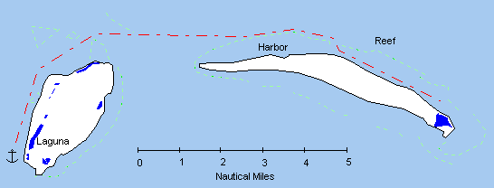
One of the enduring controversies surrounding the identity of San Salvador is the correct translation of the word laguna. Columbus says that San Salvador has a very large laguna in the middle, which has been variously rendered as "lake" and "lagoon". The modern Diccionario of the Royal Spanish Academy defines laguna as "A natural deposit of water, generally fresh and commonly of smaller dimension than a lake." The Harper-Collins Spanish dictionary agrees, translating the term as "pool". But these are modern usages; do they conform to 15th century usage? And, specifically, does the word laguna imply either fresh or salt water, and does it imply any kind of size?
Other than the case at hand, there are eight times when laguna or lagunas is used in the Diario. In one case, Columbus uses the phrase laguna de mar ("pool of the sea") to describe a saltwater feature, even though it is obvious from the context that the feature is part of the sea. It is therefore reasonable to suppose that if the laguna on San Salvador was part of the sea, or an arm of the sea, Columbus would have used the phrase laguna de mar to describe it. The other seven usages of laguna all take place at the northern end of Isabela, and it is clear that the lagunas there are fresh, since Columbus fills his water casks from them. Also, Columbus describes these lagunas as being "grande", yet they are small enough to walk around and shallow enough to wade into. Therefore, Columbus appears to be using laguna in the same way as the modern dictionary: to describe a feature which is both fresh(or at least unconnected to the sea) and fairly small. The laguna on West Plana, at three-fourths of a mile long, fills both requirements perfectly. But the Diario also says that the laguna is in the middle of the island. The laguna on West Plana is not in the middle when viewed from above, but is in the middle of the coast when viewed from the vantage point of Columbus's anchorage. I have been generous in the scoring of this point to allow room for alternate interpretations.
One of the most vexing clues for any landfall theory is the peninsula that Columbus describes as being a good place for a fort. No candidate island has such a peninsula at the present time. Proponents of Watlings, Samana, Egg, and Conception point to islands separated from their main island by shallows, which are supposed to have been sand-filled in 1492 and since washed away by storms. The Plana theory proposes the reverse process: the far end of the peninsula has become attached to the main island by sand deposition in the intervening centuries, forming an inland lagoon. There are currently two such lagoons at Plana which may have been the site of such deposition, one at the east end of East Plana. Each lagoon has two isthmuses which, if either were eliminated, would make the required peninsula. Core samplings could determine if any of the four isthmuses were a recent feature. Since the Plana theory is open to criticism on this point, I have given it a 0 on the scoresheet, pending definite geological evidence. It is interesting to note in this context that Judge's original peninsula candidate, on the southern shore of Samana, has been proven a recent feature of non-cemented sediments. It therefore seems possible that the feature seen by Columbus could have been entirely sand-based, and could have entirely washed away in the intervening time, without leaving any clue for modern scholars.